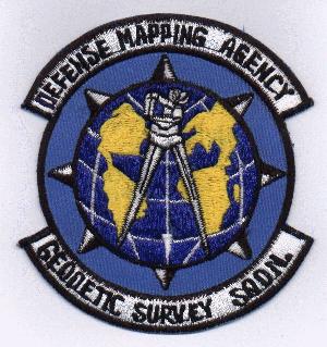
Geodetic Survey Squadron
Unit History
Text originally prepared 26 May 1987.
CLICKFor Revised current History By Gordon Barnes
CLICKFor Minuteman G and G Comments
The Geodetic Survey Squadron (GSS) was a highly specialized, highly technical military organization with its heritage dating back only to 1959. The following brief organizational history, compiled from the GSS "Commander's Briefing Guide," and other sources will give an understanding of the organizational complexities involved.
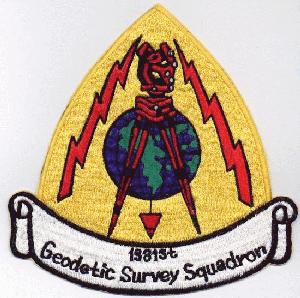
The Geodetic Survey Squadron was formed on 1 July 1959 at Orlando AFB, Florida, as part of the Air Photographic and Charting Service and was designated the 1381st Geodetic Survey Squadron (Missile). The formation of this dedicated Air Force survey unit was in direct response to survey requirements for the rapidly developing Intercontinental Ballistic Missile systems. With a complement of 13 officers, 40 enlisted, and 7 civilians, the unit was augmented by field survey and data reduction elements of the United States Coast and Geodetic Survey, United States Army Corps of Engineers, and the Army Map Service.
The 1381st Geodetic Survey Squadron moved to Francis E. Warren AFB, Wyoming in 1965 under the Military Airlift Command's 1370th Photomapping Wing. The squadron reached its peak in manpower, with 69 officers, 361 enlisted, and 32 civilians, manning the squadron and its detachments at Vandenberg, Ellsworth, Malmstrom, Grand Forks, and Whiteman Air Force Bases.
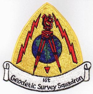
The organization was redesignated the 1st Geodetic Survey Squadron, under the Aerospace Cartographic and Geodetic Service, in the Fall of 1968.
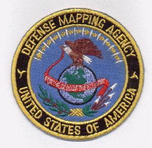
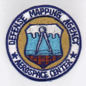
The organization was again renamed on 1 July 1972 and became the Geodetic Survey Squadron (GSS), a part of the newly formed Defense Mapping Agency. Assigned to the Aerospace Center located in Saint Louis, Missouri, its mission expanded to include geodetic support of other DoD and government agencies.
*******
GENERAL ORDER NUMBER 3, 30 JUNE 1972, DEFENSE MAPPING AGENCY ORGANIZATION.
1. In accordance with DoD Directive 5105.40, the following organizations are established as components of the Defense Mapping Agency effective 1 July 1972. The attached enclosure depicts the DMA organization.
...
Organization...
Present Designation...
1st Geodetic Survey Squadron
F.E. Warren AFB, Wyoming
...
DMA Designation...
Defense Mapping Agency
Aerospace Center
Geodetic Survey Squadron
F.E. Warren AFB, Wyoming
...
2. Directors. The following personnel are appointed Directors:
...
DMA Aerospace Center Colonel B. L. Schatzley (USAF)
...
/s/ HOWARD W. PENNEY
Lieutenant General, USA
Director
On 1 August 1976, a "new" Geodetic Survey Squadron was formed, composed of military and civilian personnel from the old unit, and civilians from the Topographic Center in Brookmont, Maryland, under the Topographic Center. Included were detachments at Vandenberg, Patrick, and Holloman Air Force Bases, and White Sands Missile Range.
In September 1978, as a result of the merger and reorganization of the Topographic Center and Hydrographic Center, the GSS held division-level status under the Geodesy and Surveys Department of the Defense Mapping Agency Hydrographic/Topographic Center. On 13 April 1980, the squadron was realigned and given department level status under the same Hydrographic/Topographic Center. The squadron celebrated its 25th Anniversary on 1 July 1984.
General Orders No.7, "Command Responsibility Realignment for the Geodetic Survey Squadron" were published on 16 March 1987 by the Defense Mapping Agency Hydrographic/Topographic Center. Paragraphs one and two are of particular interest for developing an understanding of the current organization, and are quoted below.
"1. The Geodetic Survey Squadron (GSS), Geodesy and Surveys Department (GS) is realigned so that the Commander, GSS, as the senior military officer of a geographically separated unit, reports to the Director, DMAHTC, for administrative management, policy decision-making, execution of management decisions and command responsibilities involving the health, welfare, morale and discipline of GSS-assigned personnel."2. The GSS remains an organizational element of GS and is under the operational authority of that Department for tasking, technical guidance and all aspects of support and coordination of the geodetic survey mission. The GS is also responsible for development of the total survey program to the annual Program Objective Memorandum (POM) and the implementation of program decisions."
In 1989, the Geodetic Survey Squadron became the Geodetic Survey Group (GSG).
In 1993, the Air Force, with the end of the Cold War, eliminated the Geodetic Surveyor career field, AFSC 222x0. The Geodetic Survey Group was disbanded in October 1993. The responsiblity for geodetic surveys was absorbed by the Defense Mapping Agency, Department of Geodesy and Geophysics.
HarlyD13 Note:
I was a civilian employee (Geodesist) with the Geodetic Survey Squadron from
March 1985 until the unit was disbanded.
The Survey Squadron personnel were
primarily field geodetic surveyors, with the emphasis on "field". Survey Squadron
personnel worked on all seven continents, under harsh, sometimes dangerous, conditions.
The geodetic survey instruments were heavy, awkward to carry, and delicate, and the
surveyors backpacked it all from where the road stopped to the survey mark (for some reason the
survey marks were always at the tops of mountains or in the middle of swamps or deserts).
Transportation constraints often meant that creature comforts (like food and shelter)
were left behind to make room for more equipment. Long deployments were the rule,
and the reward for a thankless job well done was usually another thankless job.
This page is intended as a tribute to the under-appreciated Geodetic Surveyors who
were members of the Geodetic Survey Squadron. I would like to expand and extend
this page and I would appreciate copies of any materials (information, personal
histories, or photographs) that former Survey Squadron members might care to submit.
Copyright 2001, All rights reserved
You may e-mail me at: HarlyD13@yahoo.com.