
Pictures By Paul J. Wise
Hi Jim,
Been a while but I have been continuing my research into the SW Pacific Survey (AST7) and its links to Australian Survey & Mapping. I tracked down a colleague who I knew had been in Papua New Guinea on the Australian geodetic survey at the time the SW Pacific survey was on-going and after much persuasion got him to go through his slides.
He turned up one he had taken himself and another two which were duplicates that he had got from another (now unknown) colleague.
Now that I have scanned them he has given me permission to pass them on to you for your site.
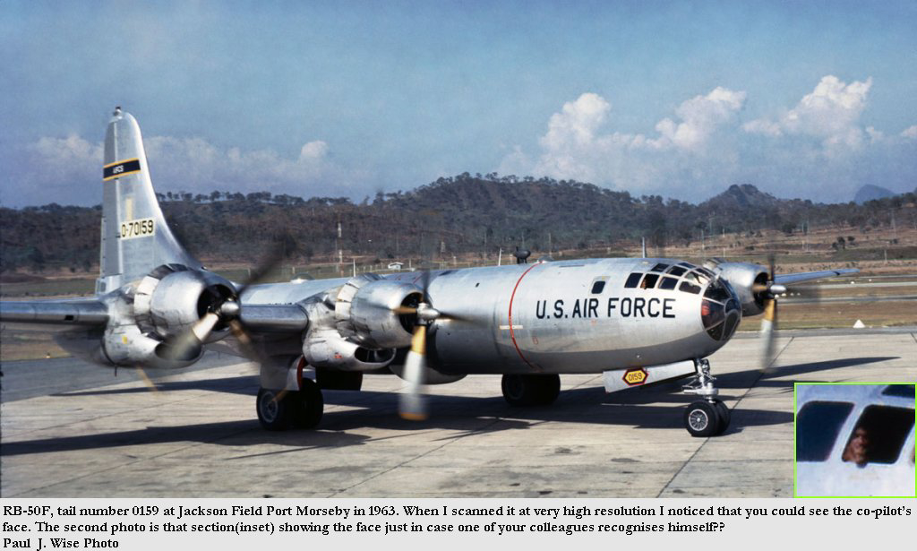
The first is a B-50, tail number 0159, at Jackson Field Port Morseby, in 1963. When I scanned it at very high resolution I noticed that you could see the co-pilots face. The photo(inset), is that section showing the face just in case one of your colleagues recognises himself.
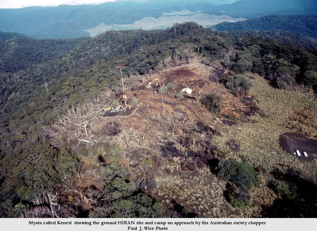
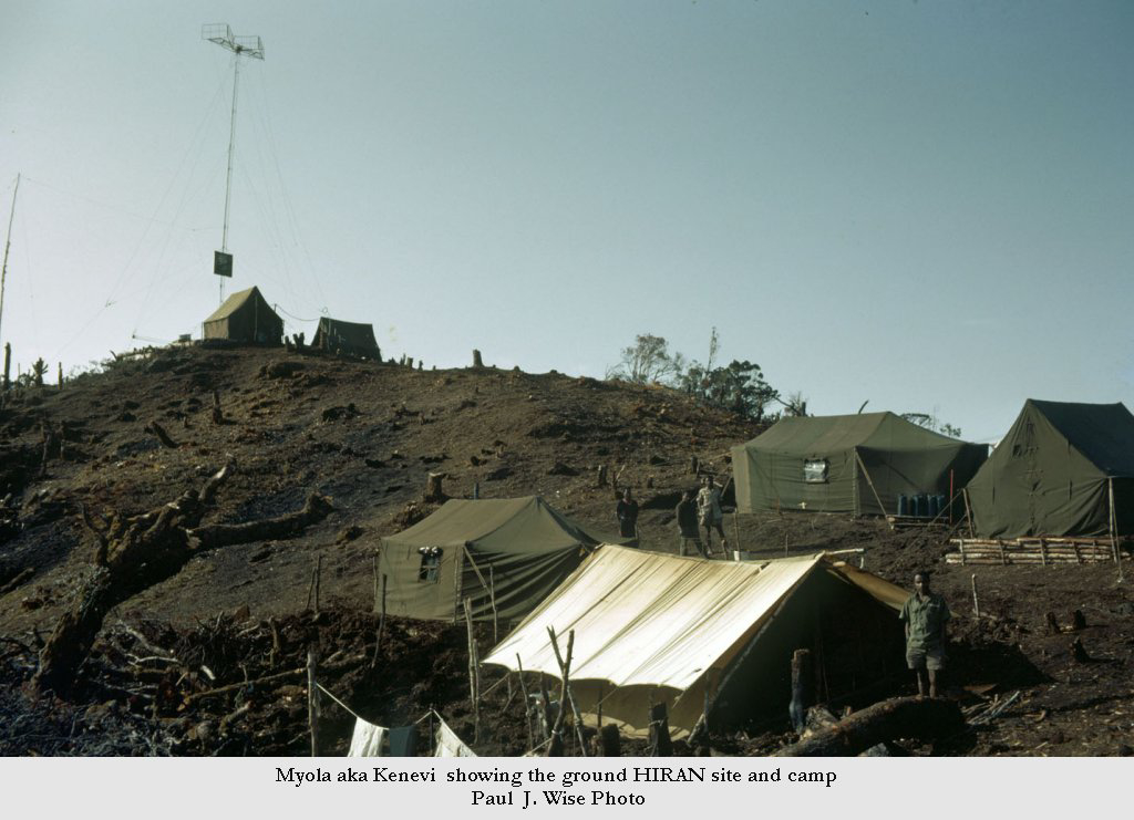
The last two are of Myola called Kenevi by us showing the HIRAN site and camp and the site again on approach by the Australian survey chopper both are july 1963.
Hope these are of interest to you and your colleagues?
Regards,
Paul
Click On Thumbnails For Larger Image
![]()
![]()