Click Thumbnails For Larger Image
The Distant Early Warning Line
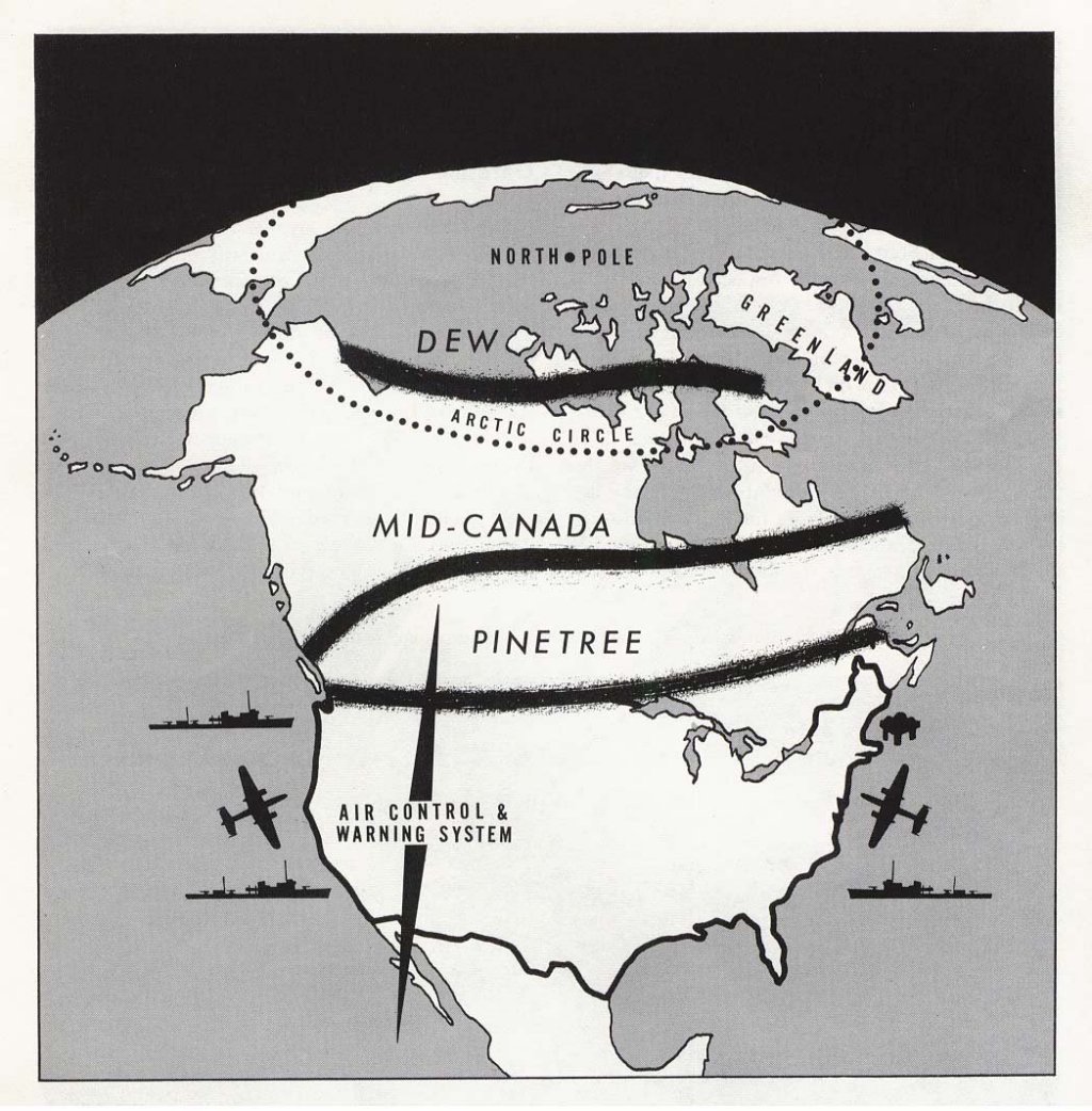
The Distant Early Warning (DEW) Line was a system of radar stations in the far northern Arctic region of Canada, with additional stations along the north coast of Alaska, across Baffin Island and Greenland. Like its predecessors, the Canadian-U.S. Pinetree Line and the Mid-Canada Line, it was set up to detect incoming Soviet bombers during the Cold War.
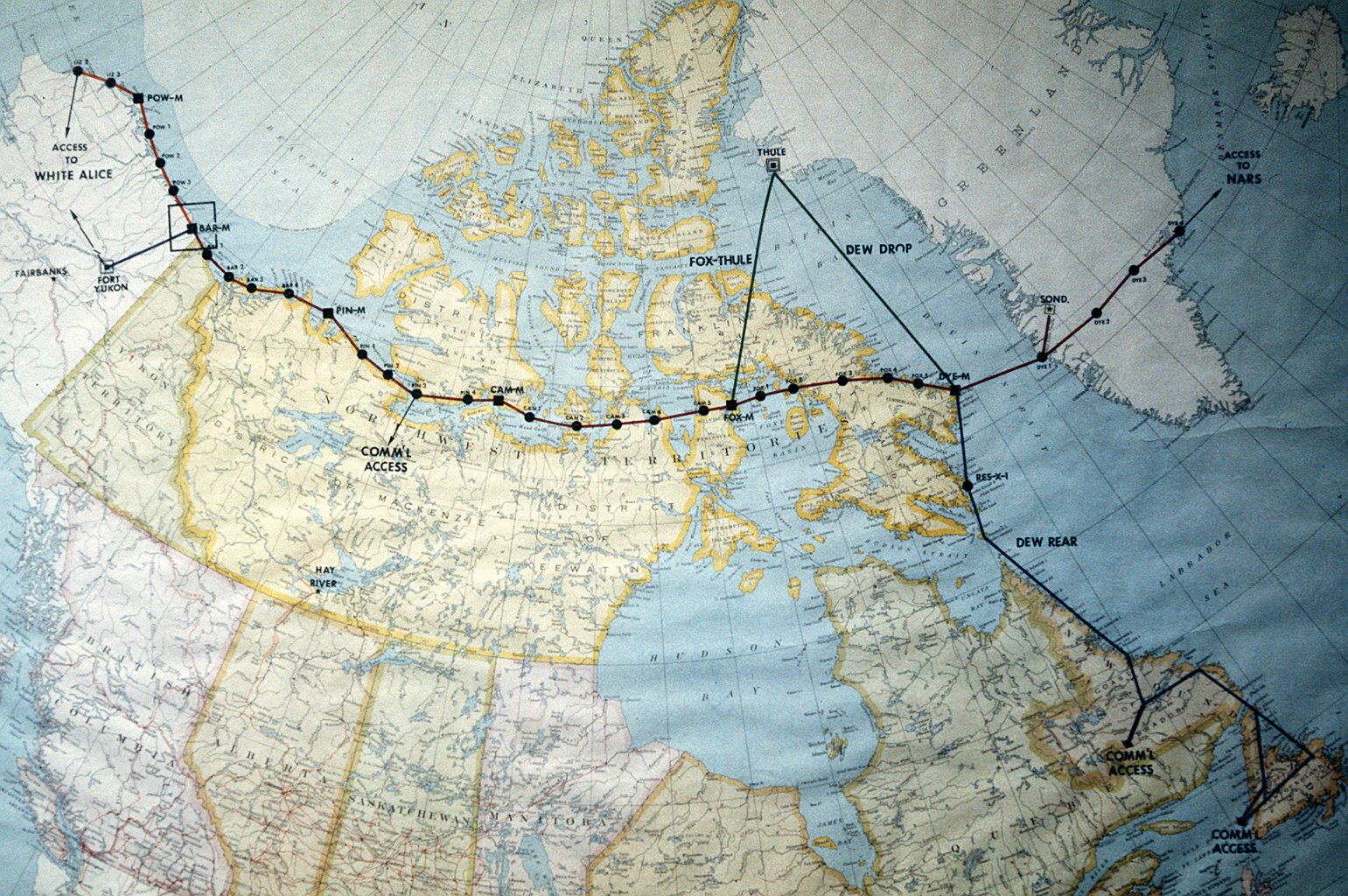
On February 15, 1954, the Canadian and American governments agreed to jointly build the new line, running roughly along the 69th parallel 200 miles north of the Arctic Circle. The Americans would pay for the line and to employ Canadian labor. The majority of Canadian DEW Line stations would be manned by the Royal Canadian Air Force, although some facilities were jointly staffed by the U.S. Air Force.
Surveying for the line was performed by Canadian and U.S. personnel. Over Alaska, photomappers of the 1370th Photomapping Group were tasked by the Aeronautical Chart and Information Center in St. Louis, an NGA predecessor, to obtain low oblique photography of the entire northern coast of Alaska. The imagery was inspected by the Army Map Service in Bethesda, another NGA predecessor, and processed into products later used to determine locations for shipping and delivering materials. The station location sites were determined by a Canadian civilian, John Anderson-Thompson.
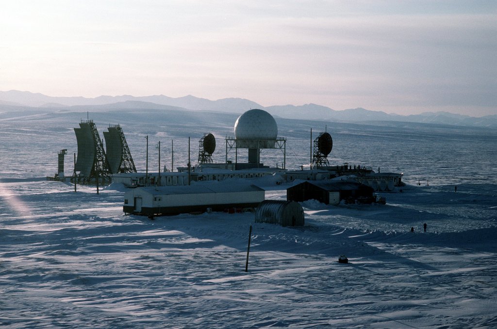
The line consisted of sixty-three stations stretching from Alaska to southern Greenland, Construction employed over 25,000 people and when finished in 1957 it was considered an engineering marvel. In 1958 it became a cornerstone of the new NORAD organization of joint continental air defense. Soon after, however, the DEW line lost much of its importance. It was useless against ICBMs and submarine-launched attacks. A number of stations were decommissioned, but the bulk were retained to monitor potential Soviet air activities and to assert Canada's sovereignty in the Arctic.
Dale Kingsbury was contacted by Wells Huff about possible Photomapping involvement in the DEW Line. He told him that in 1955 when he was there on a photomapping mission, one of our lower priority missions was the oblique photo of the north shore line. It was into July before we got to it and I think many of the ships had already been there but he dug up more on it. The St. Louis office of NGA is what was once the ACIC (Aeronautical Chart and Information Center). Wells Huff is curator of their museum and has written articles in their newsletter since 1989.
© 2008-ASAPMH and AFPMA